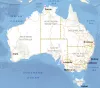
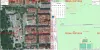
Australian cartographic viewer
Imagen
Body
Official Geoinformation Page Government of Australia Geoscience:
http://gaservices.ga.gov.au
Official Geoinformation Page Government of Australia Geoscience:
http://gaservices.ga.gov.au
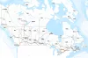
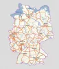
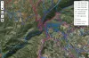
Official Geoinformation Page Government of Canada; Natural Resources Canada; Earth Sciences Sector; Canada Centre for Mapping and Earth Observation (CCMEO):
https://www.nrcan.gc.ca
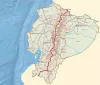
Official geoinformation page of the Military Geographical Institute of Ecuador:
http://www.geoportaligm.gob.ec
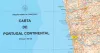
Official geoinformation pages of the Government Portuges:
Portal iGEO Geographic Information
Dire-o-Geral do Território (DGT)
Mapping used:
The tectonic plates are in continuous movement on the Earth's asthenosphere, which causes their external zones to limit each other in convergence, divergence or friction, releasing energy and producing earth tremors, which we call earthquakes. The geological results on the Earth's crust of these forces are, among others: rifts, oceanic trenches, island arcs, mountain ranges, geological faults or volcanoes.
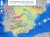
Consult all the geological mapping of Spain elaborated by the IGME in the same viewer and be able to obtain geoscientific information of different geological aspects. These include:
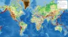
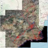
Mapping viewer with US spatial data infrastructure services, offered by different public bodies of its administration. It allows you to explore topographic maps, aerial orthophotos of specific areas or the atlas of Argentina.
Mapping used:
Historical Catastro is the tool that allows you to compare cadastral mapping on different dates to visualize the modifications that occurred. Historical mapping is only available from the time you have cartography in digital format (not before 2002) to the current date.
For more information and downloads:
http://www.catastro.meh.es/
The layouts created by the Strava app, dedicated to serving as a GPS tool for athletes around the world, provides us as a whole with an immense network of paths. The data is created from the daily use by the users of the Strava App, who incorporate the tracks of their sports outputs. The Big Data sum of all of them results in a heatmap of the most frequent routes. We can get different heatmap depending on the activity: cycling, running, swimming or winter activities.
For more information and to download cartography:
http://portaleslr.carm.es/web/sitmurcia
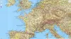
French IGN official viewer page:
https://www.geoportail.gouv.fr/carte
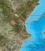
For more information and download of cartography of the Valencian Community:
http://www.icv.gva.es
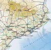
More information and cartographic files to download at:
http://www.icgc.cat/